
PISMO BEACH, California — November 20, 2026. A new or continuing official coastal hazard bulletin issued Friday sets out the Thanksgiving-week forecast for Pismo Beach and its surrounding coastline. This is a forecast-based update, not a claim that a named local street, pier or harbor has already been closed.
IMPORTANT NOVEMBER 21 UPDATE: NWS Warns Surf Could Build to 15–20 Feet by Wednesday
The National Weather Service Los Angeles/Oxnard Coastal Hazard Message issued at 11:55 a.m. PST Saturday, November 21 has added a High Surf Advisory for San Luis Obispo County beaches from 6 a.m. Sunday, November 22 until 3 p.m. Thanksgiving Day, November 26. The bulletin expects 9–11-foot breaking waves initially, increasing to 15–20 feet Wednesday, November 25, across exposed parts of the regional forecast area. Dangerous rip currents, hazardous shore breaks and beach erosion may occur. These are regional wave forecasts, not a measured wave height at the pier or a confirmation of any particular pier closure.
A separate Coastal Flood Advisory runs 3 a.m. Monday, November 23 to 3 a.m. Wednesday, November 25, followed by a Coastal Flood Watch through Thursday afternoon for possible more significant flooding. NWS says the highest flooding concern is near morning high tides, approximately 8–10 a.m.. A watch is a forecast for possible impacts, not a report that all coastal roads are closed. Visitors should avoid rocks, seawalls and exposed shorelines; never cross a closed gate or drive through water. Check current city, harbor or State Parks access restrictions before travel.
Earlier November 20 forecast: 7–10-foot surf
The National Weather Service Los Angeles/Oxnard Coastal Hazard Message updated at 8:44 p.m. Friday, November 20 continues a Coastal Flood Advisory from 3 a.m. Monday, November 23, through 3 a.m. Wednesday, November 25, followed by a Coastal Flood Watch for potentially significant flooding from late Tuesday night through Thursday afternoon. In the affected west- and northwest-facing beach forecast zones, NWS warns of large breaking waves of 7–10 feet and dangerous rip currents, with the strongest combination of tide and surf possible Wednesday or Thursday. These are regional forecast conditions, not an observed wave height or confirmation of a closed pier at this specific beach.
Readers should avoid standing on exposed rocks or seawalls to photograph waves, check current local access rules, and never enter surf or floodwater to retrieve property. Check the NWS Los Angeles/Oxnard office and locally responsible city, harbor or State Parks operators immediately before a trip. The advisory reflects flooding expected in some vulnerable areas, while a watch flags flooding that is possible: do not describe the watch as a verified evacuation order or citywide road closure.
Warning dates and what they mean
A high-surf advisory issued November 20 covered 7–10-foot breakers through 3 p.m. Friday. A Coastal Flood Advisory follows Monday November 23 at 3 a.m. until Wednesday November 25 at 3 a.m. The Coastal Flood Watch covers the period beginning late Tuesday night through Thursday November 26 afternoon.
What is specifically at risk near Pismo Beach?
The NWS specifically identifies Pismo Beach and the Pismo Pier among exposed coastal sites. This is a forecast affecting beaches and low-lying coastal property; it is not a confirmation of a closure of Pismo Pier, city parking, or Highway 1. Visitors must rely on city and State Parks notices for access status.
Before holiday visits
A combination of large breaking waves, rip currents and higher tides can make rock, pier and shoreline photography hazardous, even when the sky appears clear.
Do not drive through flooded roadways or past barricades. Stay off exposed rocks or seawalls during elevated surf. Protect vulnerable waterfront property where safe, monitor official tide alerts and check the operator responsible for any named facility rather than treating a regional watch as an individual closure order.
Sources and update policy
National Weather Service Watch/Warning/Advisory official text, November 20, 2026; NWS Los Angeles/Oxnard forecast office; California State Parks Pismo State Beach. Alerts may be revised; always check the latest version.
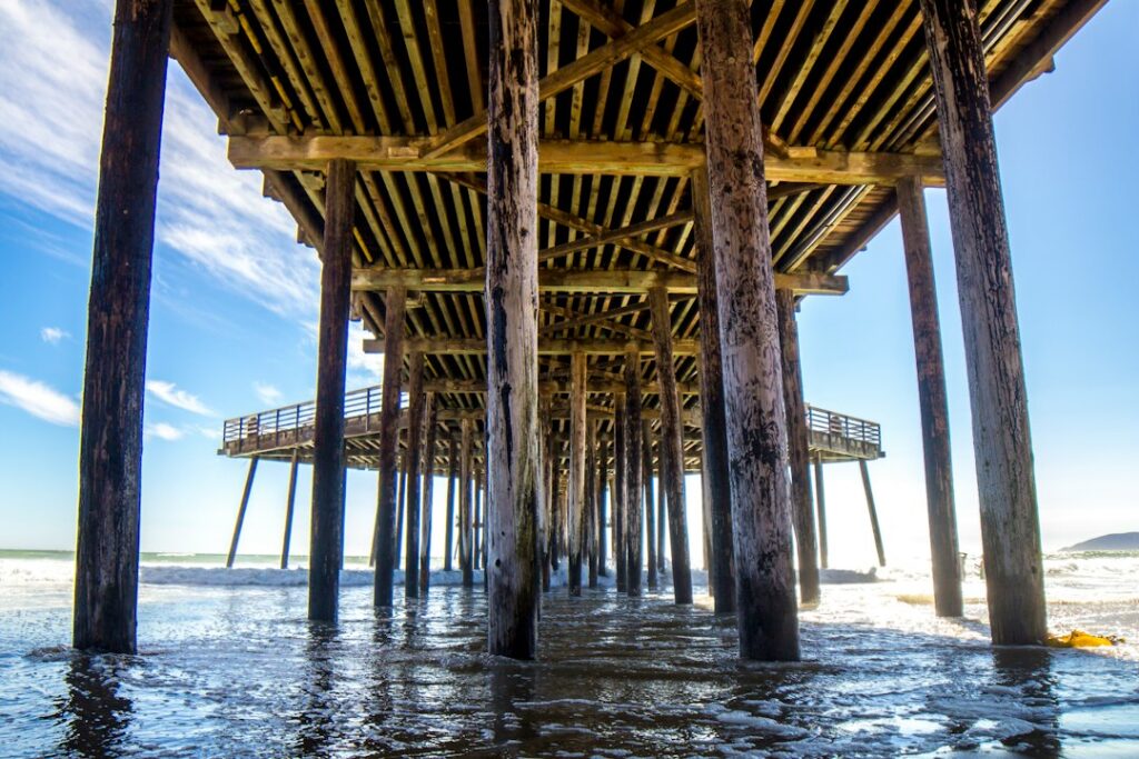
Photo is illustrative, not an image of November 2026 flooding. Published by California 58, November 20.
Support Pismo Beach News
Choose how to support Pismo Beach News:
Credit / Debit Card via StripeChoose your contribution amount on the secure California58 Stripe checkout. One-time support for independent local journalism.
Continue with PayPal Continue with ZelleZelle payments go to Vitaly Ataev Troshin. Please verify the recipient in your bank before sending. Availability depends on your bank.
Optional reader support. When possible, add “Pismo Beach News” to the payment note. Contributions are not advertised as tax-deductible. Support does not influence editorial decisions.More from Pismo Beach News
- Pismo Beach U.S. 101 Five Cities Project Completes 1,200-Foot Retaining Wall Concrete Work →
- Pismo Beach Rain and Flood Advisory November 19: Roads, Runoff, Coastal Surf and Wind →
- Thanksgiving in Pismo Beach: Take a Thanksgiving walk to the Pismo Beach Pier →
- Pismo Beach Beyond the Highway Camera: a beachfront city on the Highway 101 and Highway 1 connection →
- Pismo Beach man convicted of violating domestic-violence protective order →
COMMUNITY
Comments
Join the California58 conversation. You must be signed in to comment.
Create a free California58 account or sign in with an available social provider.